
Good News: We May Be Able to See the Mountains Again Soon
But don't hold your breath. Or, maybe do? According to the National Weather Service, the smoke situation may actually get better in the coming days, at least for a little bit.

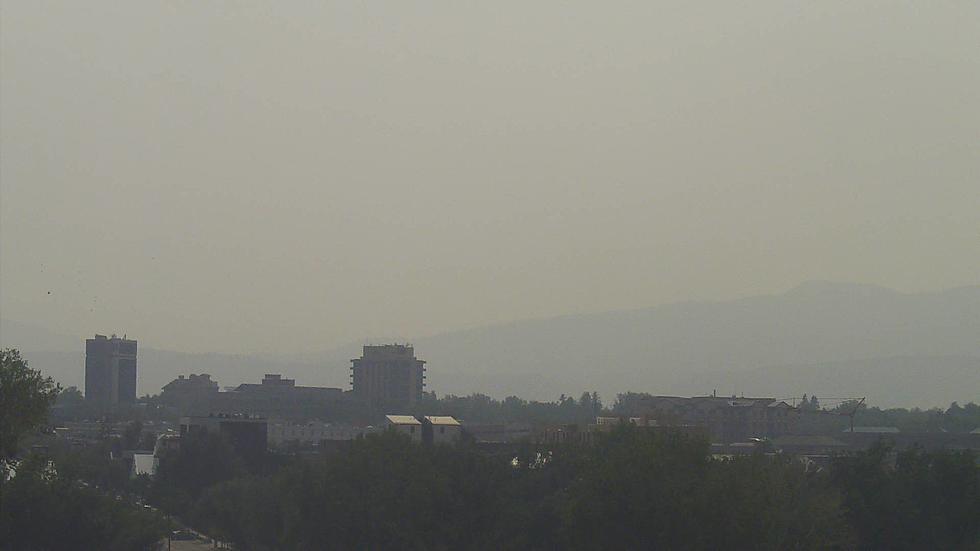
Last weekend, the amount of smoke in the Fort Collins area was not only unhealthy, but it totally ruined any fun outdoor plans you may have had. It's been a while since we've even been able to see the mountain peaks, let alone the Front Range of the Rockies. You can see the photo below, from the City of Fort Collins' air quality webcam. As of August 12 at 10 a.m., you can at least see the 'A' again.

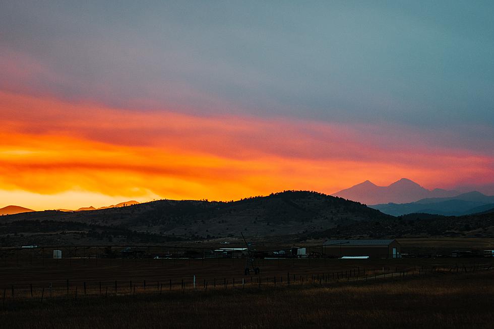
Last week was a different story.
But, the smoke that's drifted into the Mile High from wildfires in the Northwest is expected to stay to the east of us starting Friday. The National Weather Service said that 'smoke will decrease substantially by Friday afternoon with only very light amounts noticeable,' thanks to a cold front that has been keeping smoke from drifting east.
After a week of record-high temps, the Fort Collins area will also be slightly cooler starting Thursday, with a high of 88 degrees and a high of 85 degrees on Friday. Both days could see thunderstorms and rain as well. The weekend will warm back up to the low-to-mid 90s. You can see a full forecast from the National Weather Service here.
Unfortunately, this haze relief may only be temporary. The National Weather Service also said that there's a good chance that heavier smoke will return to the area to start off next week.
6 'Easiest' 14ers To Hike in Colorado
More From Retro 102.5


